How Satellites Are Saving Lives on Earth
High above us—silently orbiting the planet—thousands of satellites are doing more than just providing GPS and TV signals. They’re helping save lives.
From detecting natural disasters before they strike to tracking deadly disease outbreaks, satellites have quietly become Earth’s first responders in the skies. These high-tech eyes in space are changing the way we respond to emergencies, fight climate change, and protect vulnerable communities.
Also check for : predicting-the-future-with-data-too-accurate-to-ignore
This isn’t tomorrow’s tech. This is happening right now.
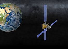
🛰️ More Than Space Gadgets: Satellites at Work
When you think of satellites, you might picture weather forecasts or communication signals. But their capabilities have grown far beyond that.
Today’s satellites:
-
Monitor wildfires in real time
-
Detect deforestation and environmental hazards
-
Track ships involved in illegal activity
-
Map refugee camps and conflict zones
-
Alert agencies about crop failures or famine risks
They’re vital tools in global crisis management—and they operate 24/7, anywhere on Earth.
🌪️ Predicting and Responding to Natural Disasters
Satellites are our early-warning systems for some of the world’s deadliest events:
✅ Hurricanes & Cyclones
Weather satellites can forecast storm paths, wind speeds, and intensities, giving populations crucial hours or days to evacuate.
🔥 Wildfires
Infrared satellites detect heat signatures, enabling firefighters to pinpoint hot zones—even in remote forests—before they spread out of control.
🌊 Tsunamis & Floods
After an earthquake or heavy rainfall, satellite images help assess the extent of flooding in inaccessible areas, guiding emergency aid and rescue.
The result? Faster responses, more lives saved, and reduced damage.
📡 Fighting Disease from Space
Yes, satellites even play a role in stopping global pandemics and epidemics.
By monitoring environmental conditions like humidity, rainfall, and temperature, satellites can predict outbreaks of diseases such as:
-
Malaria (mosquito breeding patterns)
-
Cholera (contaminated water sources)
-
Zika & Dengue (tropical spread patterns)
NASA and the WHO have teamed up to use satellite data for epidemic mapping—so outbreaks can be targeted before they escalate.
🧭 Locating People in Danger
When disaster strikes—earthquakes, floods, hurricanes—ground communication often fails. That’s where satellites step in:
-
GPS-enabled devices help locate missing persons.
-
Rescue teams use satellite phones to coordinate efforts when cell towers are down.
-
Satellite imaging can quickly reveal where infrastructure has collapsed and where survivors may be trapped.
In war zones, satellites are also used to monitor troop movements, detect human rights abuses, and provide aid organizations with real-time situational awareness.
🌍 Climate Monitoring & Environmental Protection
Satellites help safeguard the planet—and the people on it.
They:
-
Track air quality and pollution spikes
-
Measure glacier melting and sea-level rise
-
Monitor carbon emissions and forest loss
-
Help enforce international climate treaties
This data helps scientists and governments take preventive action, not just reactive responses.
In fact, many global climate goals rely heavily on satellite intelligence to measure impact and adjust strategies.
🧠 Real-World Examples
-
Turkey-Syria Earthquake (2023): Satellite data helped map the damage zone within hours, speeding up international rescue efforts.
-
COVID-19 Response: Satellite imagery tracked reduced human activity and pollution levels during lockdowns—helping study virus spread patterns.
-
Africa’s Famine Warnings: Satellites from the Famine Early Warning Systems Network (FEWS NET) have helped prevent food crises across Sub-Saharan Africa.
⚠️ The Challenges Ahead
Satellites are powerful, but they’re not perfect:
-
Data overload – Thousands of images and signals flood systems daily; sorting critical info quickly is key.
-
Privacy concerns – Surveillance via satellite raises ethical and legal questions.
-
Space debris – With thousands of satellites orbiting, collisions and malfunctions could disrupt life-saving missions.
Still, the benefits far outweigh the risks—especially when lives are at stake.
🚀 What’s Next in Satellite Tech?
The future of satellite rescue is even more precise and proactive:
-
AI-powered image analysis for faster disaster response
-
Mini-satellites (CubeSats) providing low-cost, focused coverage
-
Earth-observing constellations tracking the planet in near real-time
-
Integration with drones and ground robotics for seamless rescue operations
Soon, satellites will not only see disasters—they’ll help automate the global response.
🧭 Final Thought
Satellites may be out of sight, but they’re never out of action. From disaster zones to disease prevention, they are silently working overhead to make Earth safer.
They don’t just orbit the planet—they protect it.
So next time you look up at the night sky, remember: someone’s life might be saved right now—thanks to a machine floating in space.